
Sunday, November 27, 2005


Friday, November 25, 2005


Wednesday, November 23, 2005
Finding Amy on Google maps

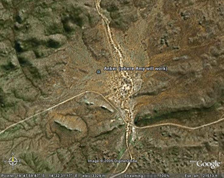
I have always felt that finding a place on a map helps you feel a little like you are there. It has been frustrating to find so little about Anker where Amy is right now. However I discovered a way to find it on Google Maps and Google Earth.
I typed " latitude longitude Anker Namibia" in to Google and found a health clinic website that had the coordinates for an Anker Clinic. It seems there are at least two Ankers in Namibia and this one is in the area that Amy described
I then pasted those coordinates into Google Maps and this is the satellite photo of Anker, Nambia. You can zoom in or out to see more detail although there isn't much to the town:
Anker, Namibia
I did the same for Kamanjab and it gave me a location about 30 miles ENE of there:
Kamanjab, Namibia

And Kamanja to Anker:

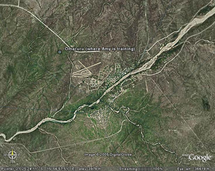
Also Omaruru:
Omaruru, Namibia
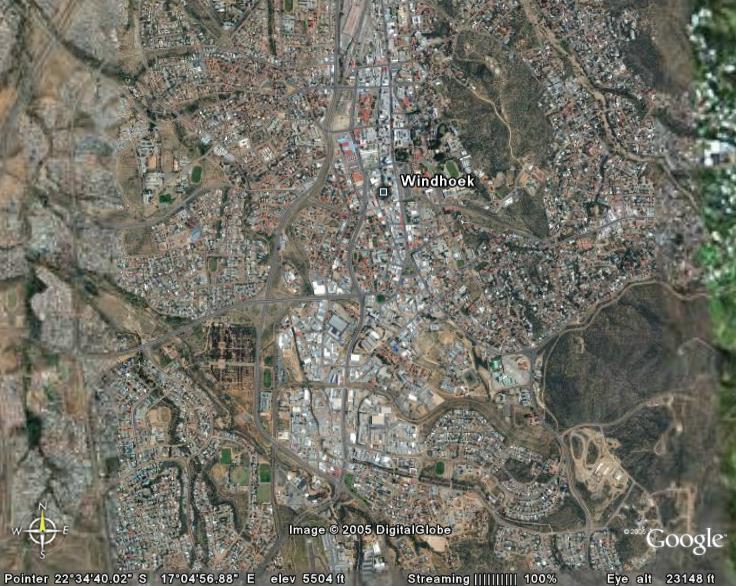
and Windhoek:
Windhoek, Namibia
None of these are in high resolution, but you can see roads, terrain and blurry buildings.
Google Earth is even better if you have downloaded it and if you enter the following coordinates into the search space:
Anker -19.78500 14.53000
Kamanjab, Omaruru and Windhoek, Namibia - just type the city and country name in the space
Windhoek is in high resolution so you can actually see individual buildings.
Sunday, November 13, 2005


Subscribe to:
Posts (Atom)

